Abstrat
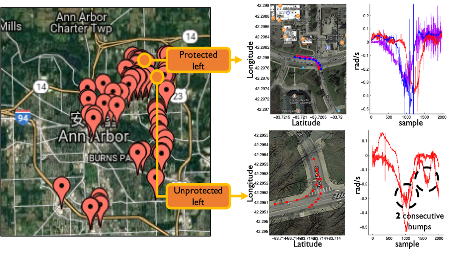
Left turns are known to be one of the most dangerous driving maneuvers.1 An effective way to mitigate this safety risk is to install a left-turn enforcement — e.g., a protected left-turn signal or all-way stop signs — at every turn that preserves a traffic phase exclusively for left turns. Although this protection scheme can significantly increase the driving safety, information on whether or not a road segment (e.g., intersection) has such a setting is not yet available to the public and navigation systems. This paper presents a system, called TurnsMap, that exploits mobile crowdsensing and deep learning to classify the protection settings of left turns. One of our key findings is that crowdsensed IMU sensor (i.e., gyroscope and accelerometer) data from onboard mobile devices can be used to recognize different types of left-turn protection. TurnsMap first collects IMU sensor data from mobile devices or smartphones carried by the driver/passenger(s) in a moving car. It then feeds the data to an analytics engine powered by: (1) a data mining engine for extracting and clustering left turns by processing raw IMU data, and (2) a deep-learning pipeline for learning the model from the IMU data to identify the protection type of each left turn. We have built and used a large-scale real-world driving dataset to evaluate TurnsMap, demonstrating its capability of identifying different left-turn enforcements with 90.3% accuracy. A wide range of automotive apps can benefit (e.g., enhancing traffic safety) from the left-turns information unearthed by TurnsMap.