Helicopter Assisted Landing System Using
MMW Radar
Feinian Wang,
Mustafa Rangwala, and K. Sarabandi
Landing
on unprepared surfaces, such as snow-covered terrain or uneven ground, has
always been considered hazardous for the helicopter operation. A specialized,
low cost, all-weather sensor is needed to aid the pilot in selecting safe
landing site, by detecting the terrain topography underneath the helicopter
with reasonable spatial resolution. Millimeter-wave (MMW) radar technology is
best suited for this purpose. A 2-D scan of the terrain provides the range from
each pixel to radar, based on which surface elevations are computed to form the
topography.
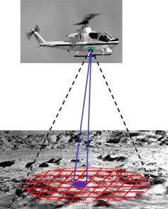
Figure 1: 2-D scan of the underneath terrain by a MMW
radar on board of the helicopter.
(a)
(b)
(c)
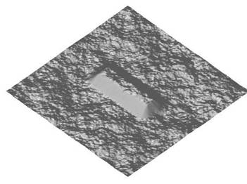
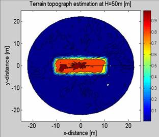
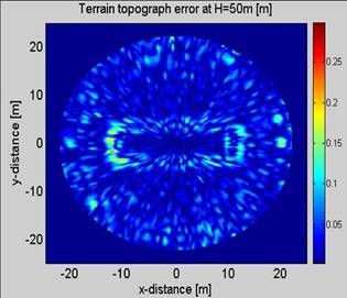
Figure 2: (a) A computer-generated terrain with a hump
in center; (b) detected terrain topography with the hump clearly observed; (c)
terrain topography detection error.